Sri Lanka is a paradise island where one could enjoy the unique beauty of the environment . The photos and descriptions which I carry here will make you aware of some of the attractive places in the island. Visit Sri Lanka. Enjoy the hospitality of my country. It will be a unique experience for all of you around the world.
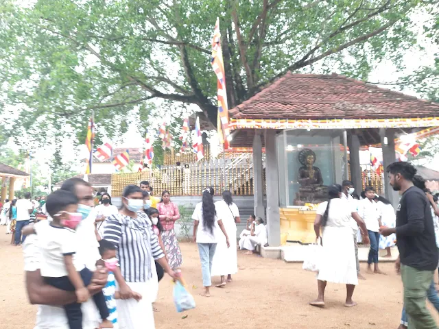
The Attanagalla Raja Maha Vihara was built by king Gotabhaya during 249-262 AD. It was later reconstructed by king Upatissa ( 365-406 AD)
Attanagalla is a small town located in the Gampaha District, Western Province , Sri Lanka. Attanagalla borders the Kegalle district in the Sabaragamuwa province. The picturesque village of Attanagalla is situated on the west bank of the Attanagalu Oya.
Attanagalla is well-known in the country due to two reasons.
historically: due to the Attanagalla Raja Maha Vihara
Attanagalla Raja Maha Vihara can easily be reached from Colombo- Kandy highway. The temple is located on the Nittambuwa - Hanwella road ( 6km. from Nittambuwa). The temple can also be reached from Pasyala.
Hulangala | Wind Rock | Newgala Viewpoint in the Mathale district
What is 'Hulangala'?
Hulangala meaning 'Wind Rock' in English is one of the few better known precipices in Sri Lanka; the most popular one being the World's End located in Horton Plains in Nuwara Eliya. MadolsimaViewpoint in Welimada is another attractive place. Hulangala is also known as Newgala because of the shape of the rock there.
Watch the video for more details of a hike to Hulangala.
The blogger's rout
The blogger together with a few friends reached the View Point via Kurunegala, Ridigama and Yatawatta. The journey from Yatawatta to the Selagama tea estate where the Hulangala viewpoint is situated is motorable, a distance of around 9 km.
Entrance
You have to buy a ticket at the entrance to Hulangala. The price of a ticket for a local tourist is Rs. 100. Also you can arrange for a jeep at the entrance for which they charge Rs.6000. However, motorcycles are allowed.
Hiking is the best
Most tourists prefer hiking while enjoying the beauty of the environment. The hiking trail falls through the tea estate. There are several improvised resting places erected for the hikers. The properly maintained tea estate provides a novel experience to the hiker specially from the low country.
The Viewpoint
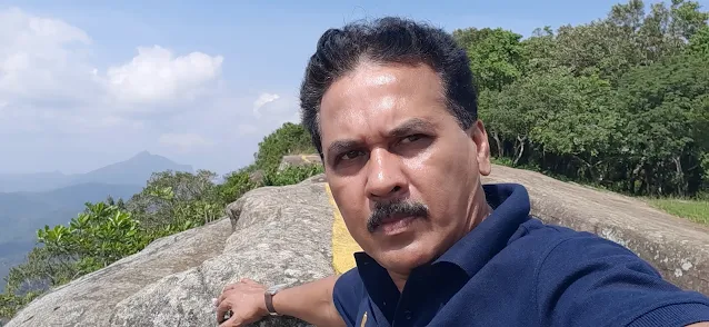
Once you reach the viewpoint , you are bewitched by the the beauty of the unique aerial view of the vast mountain ranges. The bluish mountains tinged with the patches of green is a pleasing sight which leaves an indelible memory. The view point is about 100 m long smooth rock.
The estate authorities provide facilities for camping too.
WARNING!
There is no protective guard fence at the edge of the precipice, just a painted yellow line. As the wind is sometimes strong you have to take extra precautions for your own safety, especially , if you take your kids with you.
Mulawella Rock is the fourth highest rock situated within the Sinharaja (Lion king) forest in Sri Lanka. The trail to the peak falls through the thick forest. One has to take all the precautions for protecting oneself from leaches. The friendly guides of the park provides you with all the necessary information.
The visitor also gets an opportunity to see a number of rare plants and different animal species. The pitcher plant is a common sight here. Also we could see a tree by the name 'waldurian'.
The legends behind Mulawella
There are several legends associated with the name of the rock. Some villagers say that this area was home to a kind of creepers called 'manmula vel' (vel in sinhala meaning creepers). It is said that those who step on them in a forest are sure to get lost. Hence the name 'mulawella' derives from 'manmula vel'.
The viewpoint
The viewpoint provides you a life time experience. The visitor can have a clear aerial view of the surrounding mountains and the forest from up there.
Dedugala is a small village situated within the Bulathkohupitiya Local Council area in the Kegalle district.
The blogger together with five friends visited Dedugala on the 28th July 2025. We started the journey from Attanagalla on motorcycles. The distance from Attanagalla to Dedugala is 56 Km. We travelled via Urapola, Ruwanwella, Kaluwella and Bulathkohupitiya. The complete distance was a motorable one. We could reach our destination within one and half hours.
Old Dedugala town
On our way, we did not forget to visit the old Dedugala town. The town looks more like a ghost town today. As I came to know from a villager the reason for deserting the town was due to the transport and other difficulties people had to face.
Though at present Dedugala is gradually becoming a tourist hotspot in the island, the villagers had faced immense difficulties in the past due to the lack of transport facilities and other infrastructure. There are several tea estates in the surrounding area. The majority of the community engage in agriculture. It seemed there is a mixed community in the area.
The Climate
There is a mild cold climate in Dedugala. The average temperature is around 24°C . Hence the water in the surrounding water ways is a little colder.
Waterfalls
Dedugala is home to a large number of waterfalls. Some of the waterfalls in the surrounding area are
*Malapola Ella
*Ganthuna Ella
*Devagiri Ella
*Samapth Ella
*Kumara Ella
*Nalagana Ella
*Rikili Ella (πThere are many more)
On our journey we visited the three waterfalls; namely Rikili Ella , Nalagana Ella and Kumara Ella. Out of the three the Nalagana Ella can be described as the most attractive. It is situated about 300m from the main road. The visitor is charged Rs. 100. Rikili Ella and Kumara Ella are situated by the main road. (πWatch the video attached)
Kumara Ella
Dedugala Viewpoint | Palampitiya Viewpoint
One has to move further passing the old Dedugala town to reach the Dedugala viewpoint; also known as Palampitiya viewpoint. Currently the place is maintained by the Bulathkohupitiya Local Council. The visitor is not charged any fee for entering the viewpoint. There is an attractive shelter with seating facilities and water for the visitor. The visitor can enjoy the beauty of the hilly surrounding from the viewpoint. The video below and the images bear witness to this fact. The mesmerizing aerial view provides a unique experience to the Dedugala visitor. The place is also most suitable for photo shooting. The blue tinged moutain tops combined with the azure sky create a unique natural background for young lovers to prserve a memorable click.
πAs there is no protective fence at the viewpoint the visitor has to be cautious while taking photographs standing on the edge. The existing railing does not cover the complete area. Especially , the kids needs to be protected.
Bathing spots
There are also safe bathing spots in the area. However, it is not advisable to get into the waterways without consulting the residents in the vicinity. The residents in the area are friendly and hospitable. πWatch the video attached for details of a family bathing spot.
Fruits available
Durian , Mangosteen , Avocado , Rambutan. Beside them, Kithul products are also available.
Clicks on the journey
πWatch the Video for complete tour Conclusion
Deduagala can be recommended as one of the best places for a family tour especially for those who live in Colombo, Gampaha and Kandy. There are a few hotels and restaurants in the vicinity.